
Quick verdict
- What it is
- Store information collected; independent summary not yet available.
- At a glance
-
- $12.99
Categories and search queries
Official categories
- Navigation
- Sports
AppCorpus categories
Key functions
| Function | Availability | Access | Scope | Evidence |
|---|---|---|---|---|
| Family Sharing | Yes | Unknown | App Store | Store published |
Screens
App Store
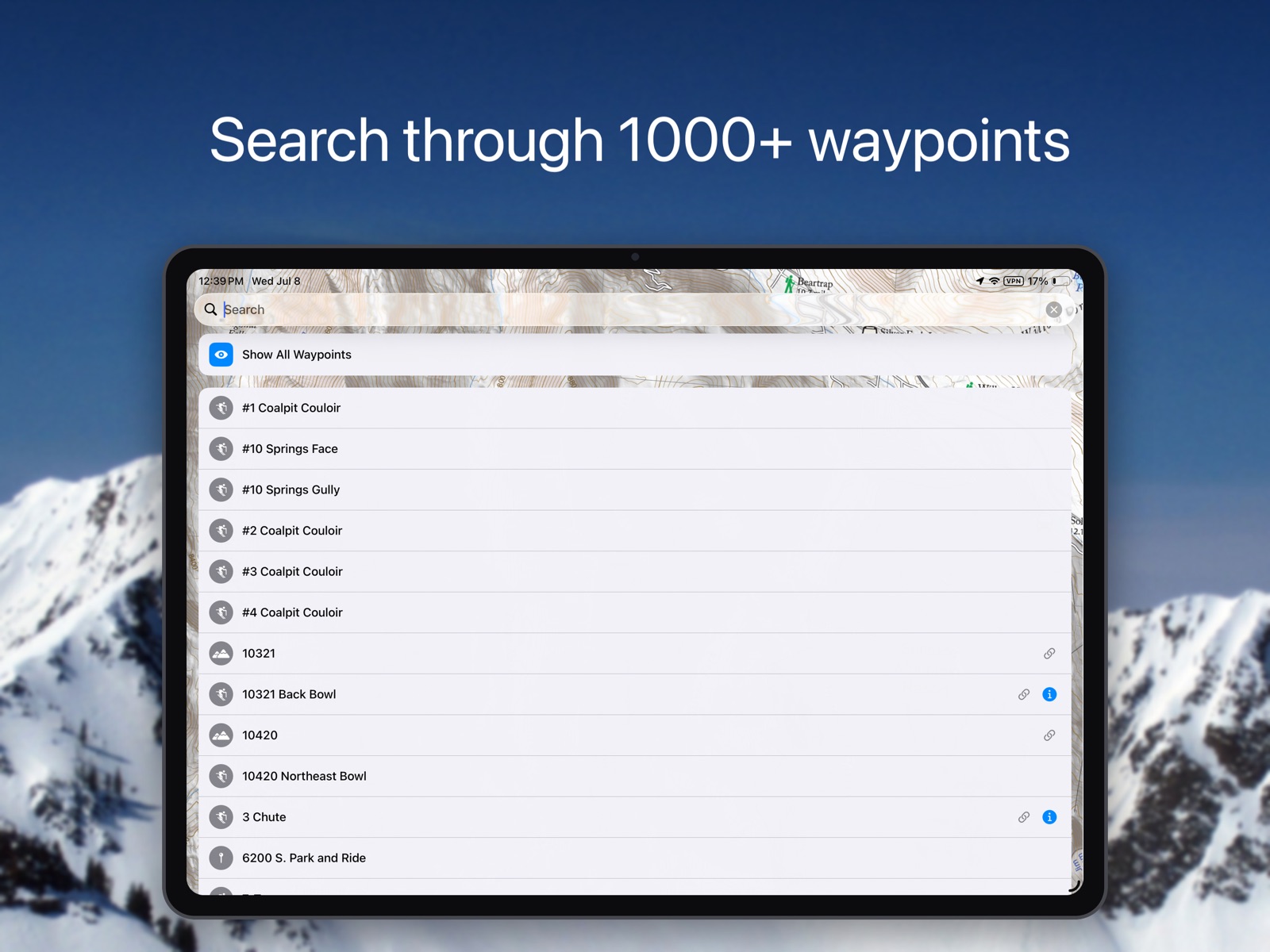
10 store screenshots



Pricing & paywalls
App Store
- Price: $12.99
Ratings & reviews
App Store
-
4/5Best Wasatch BC map, needs new contour detail map and a couple other updates.
I love how clear and easy this map is to use. I can easily take a screenshot of the map and then mark it up to send to my skiing partners. I bought the new paper map and really appreciate the higher resolution of the contour data and I wish this app had that detail. Search works well for finding locations. The iPad version doesn’t fill the entire display, not a huge deal but would be a nice fix to give me more map on my display. I kind of like the old school aesthetic of the app but it would be nice if it had some functional updates.
Gwynypig · 31 Jul 2026
-
5/5Very useful
A friend convinced me to buy this app. I'm happy that I did. It is very useful for route finding especially in places that I am not familiar with. Some of the names on certain lines seem different than what I've heard in the past but not a big deal. Could be helpful in a rescue situation by sending a screenshot of your location (assuming you have service).
Neb Clevlandstar · 31 Jul 2026
-
1/5It’s an expensive topo map
Not sure why all these 5 star reviews rave about this app. First of all, “Wasatch” is misleading - it’s a topo map that covers Millcreek, BCC and LCC. Nowhere near everything in the Wasatch. Second, it’s just a topo map with the names of popular touring areas on it. The map labels are not linked to any real information. You have to search the route name, then it takes you to the external website for any info which is al free and doesn’t require the app. The app is useful as the topo map is handy for when you’re out touring, but for the price there should be waaaaaaaay more here. It should at least have a browsable database, clickable links on the map, and the locations of popular skin tracks.
SD Guy27 · 31 Jul 2026
-
5/5Don’t tour in the wasatch without this app!
I use this app to plan if not to navigate on every tour I go on in the Wasatch. It’s simple to use, accurate, and helps me and my ski partners make good decisions in the Backcountry when exploring new or unfamiliar terrain. It’s well worth the money and should go side by side the UAC app if you’re planning on touring the wasatch area. Less complicated than Gaia, but with enough extras to be a powerful tool in your pocket when you’re on the skin track. Pro tip: You can use it while your phone is in airplane mode ;)
@dirkbadenhorst · 31 Jul 2026
-
5/5Must have for Wasatch Backcountry
Really amazing app. Must have if you plan to go into the backcountry. Useful for planning routes, looking at what’s ahead, and reflecting after. Really great app for being prepared and knowing what’s out there. One thing I always do too is screenshot the area I toured and using the drawing feature in my camera roll I try to map out the runs, tours, and areas I stopped. Well worth the money. Have fun and stay safe!
iamthejugganautbb · 31 Jul 2026
Privacy & accessibility
App Store
Privacy
- Data Not Collected Developer declared
Accessibility
No accessibility labels collected yet.
Versions
App Store
- 1.0.0
-
1.0.1
Fixed cosmetic bugs when running on iOS 7.
-
1.1.0
Allow emailing of your current location * Tweaked hundreds of backcountry locations (and added a few dozen new locations) * Allow app rotation for docked iPads * Blink the destination arrow when you arrive at your destination * Improved the accuracy of dropped pins * Added a setting to prevent map rotation when you "twist" your fingers on the map * Added a prompt to encourage you to submit a review (please do) * Etc.
-
1.1.1
Fixed a problem in version 1.1.0 that could cause a crash on some iOS versions. (Version 1.1.0 was released for less than 48 hours.)
-
1.2.0
Version 1.2.0 contains more than 50 updates to the names on the map. These changes were based on suggestions from experienced backcountry travelers. This version also fixes a problem that could cause the app to crash when the iOS device was configured for a non-English language and fixed a few bugs in the "Email Current Location" feature (which is located on the Navigation page).
-
2.0.0
Version 2.0.0 adds "slope-shading" which displays a red overlay where the calculated slope-angle is 30-degrees or greater. It also adds and improved several dozen named locations.
-
3.0.0
New shading was added to show ski area boundaries, the red slope-shading (that shows where the slope is steeper than 30 degrees) is now darker, the accuracy of the GPS was improved, dozens of minor changes were made to improve the location names, several usability improvements were made (e.g., the small compass is now always displayed on the map), and a bug on iPads was fixed (where swiping left-to-right could display a blank window).
-
3.0.1
Improved app stability (aka fixed a few bugs).
-
3.0.2
Improved ~25 items in the list of names.
-
3.5.0
This update from Apple will improve the functionality of this app. No new features are included. Version 3.5.0 is now linked to the Wasatch Backcountry Skiing Guide. After selecting any of the hundreds of linked-locations in the app and tapping on the "Tap here for more ..." box, photographs and detailed information about the location such as skiing difficulty, skinning distance, vertical climb, altitude, aspect, and slope angle will be displayed in Safari (see screenshot). You can tap on the "WBSkiing" text in the top-left corner of Safari to return to the app. Version 3.5.0 also has a new base-map with dozens of additions and improvements. As always, it's a free upgrade.
-
5.0.0
· 10 Jul 2026
Everything you love about Wasatch Backcountry Skiing Map, now dramatically better. Version 5.0.0 is a ground-up redesign built for modern iOS: a sharper, more detailed map, faster and more reliable navigation, smarter search, and a cleaner waypoint experience that makes marking and finding spots effortless. Every screen has been rebuilt to be more responsive and intuitive, with enhanced iPad support that takes full advantage of the bigger display. The contour lines and slope shading in version 5.0.0 are based on high-resolution LIDAR data, increasing the detail of the contour lines and relief shading dramatically. Improved accuracy of the "30-degree slope shading" makes understanding terrain easier than ever. Version 5.0.0 also added more than 50 waypoint names and improves the location data on hundreds of waypoints.
Alternatives
- Outmap: Ski & Snowboard Maps — Same category + similar ratings
Availability by market
- US
Data quality & evidence
- Page completeness
- Live store listing
- Last verified
- 31 Jul 2026
- Sources
- App Store
- Independent summary has not been published yet.