
Quick verdict
- What it is
- Store information collected; independent summary not yet available.
- At a glance
-
- Free to download
Categories and search queries
Official categories
- Utilities
AppCorpus categories
Key functions
| Function | Availability | Access | Scope | Evidence |
|---|---|---|---|---|
| Free app | Yes | Free | — | Store published |
Screens
App Store
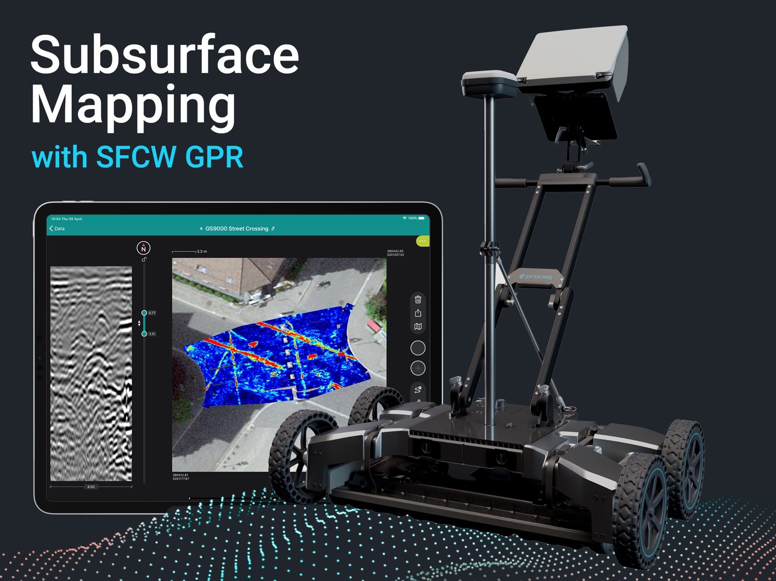
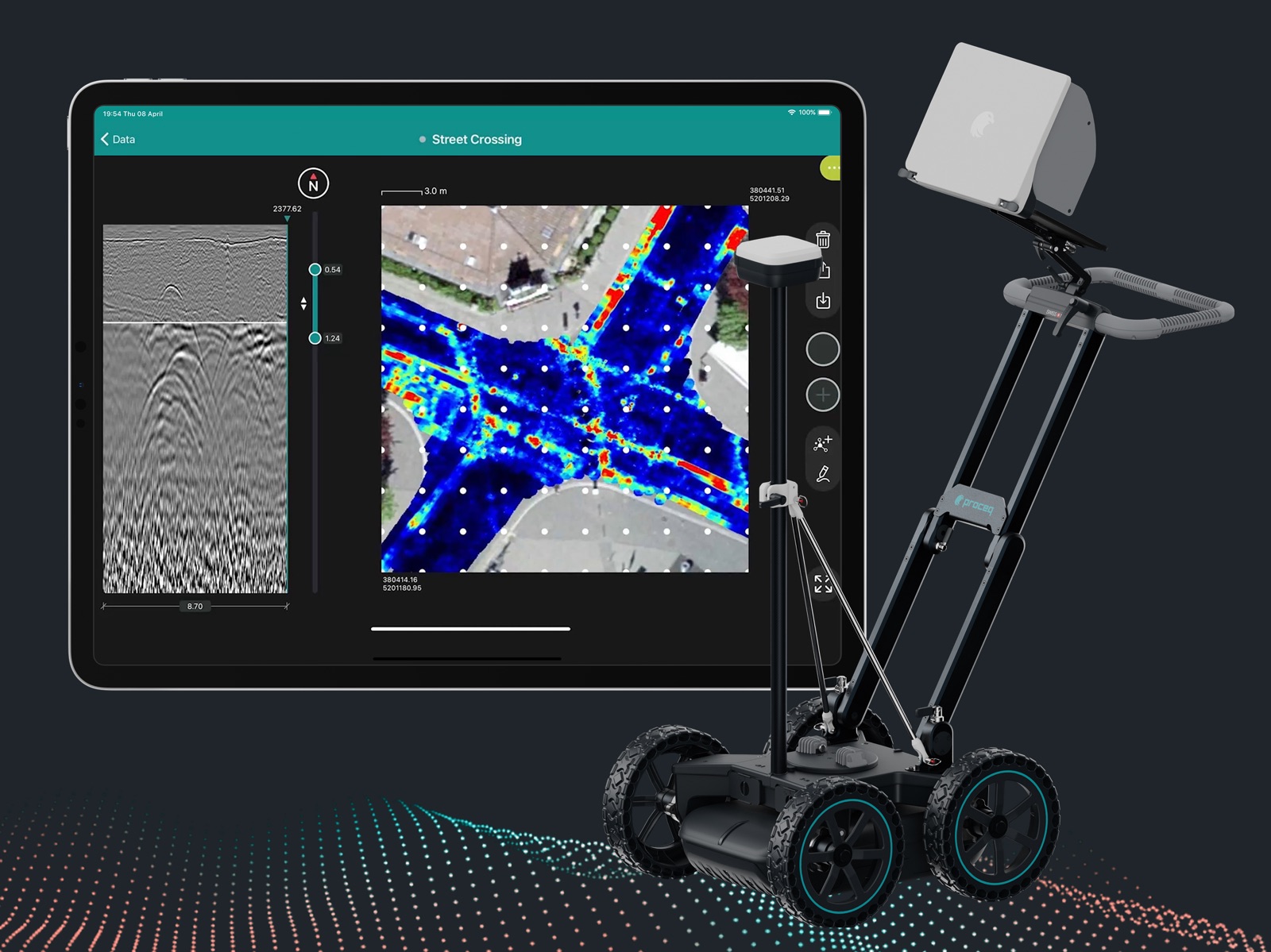
10 store screenshots


Pricing & paywalls
App Store
- Free
Ratings & reviews
App Store
-
5/5Constant updates amazing user interface
New CAD overlays are incredible, live 3D tomography is a real game changer for in field surveys
GPR - Dan · 31 Jul 2026
Privacy & accessibility
App Store
Privacy
- Data Linked to You — Analytics — Contact Info — Email Address Developer declared
- Data Linked to You — Analytics — Contact Info — Name Developer declared
- Data Linked to You — Analytics — Diagnostics — Other Diagnostic Data Developer declared
- Data Linked to You — Analytics — Diagnostics — Performance Data Developer declared
- Data Linked to You — Analytics — Identifiers — Device ID Developer declared
- Data Linked to You — Analytics — Identifiers — User ID Developer declared
- Data Linked to You — Analytics — Location — Precise Location Developer declared
- Data Linked to You — Analytics — Usage Data — Product Interaction Developer declared
- Data Linked to You — Analytics — User Content — Audio Data Developer declared
- Data Linked to You — Analytics — User Content — Other User Content Developer declared
- Data Linked to You — Analytics — User Content — Photos or Videos Developer declared
- Data Linked to You — App Functionality — Contact Info — Email Address Developer declared
- Data Linked to You — App Functionality — Contact Info — Name Developer declared
- Data Linked to You — App Functionality — Diagnostics — Other Diagnostic Data Developer declared
- Data Linked to You — App Functionality — Diagnostics — Performance Data Developer declared
- Data Linked to You — App Functionality — Identifiers — Device ID Developer declared
- Data Linked to You — App Functionality — Identifiers — User ID Developer declared
- Data Linked to You — App Functionality — Location — Precise Location Developer declared
- Data Linked to You — App Functionality — User Content — Audio Data Developer declared
- Data Linked to You — App Functionality — User Content — Other User Content Developer declared
- Data Linked to You — App Functionality — User Content — Photos or Videos Developer declared
- Data Linked to You — Developer’s Advertising or Marketing — Contact Info — Email Address Developer declared
- Data Linked to You — Developer’s Advertising or Marketing — Contact Info — Name Developer declared
- Data Linked to You — Contact Info Developer declared
- Data Linked to You — Diagnostics Developer declared
- Data Linked to You — Identifiers Developer declared
- Data Linked to You — Location Developer declared
- Data Linked to You — Usage Data Developer declared
- Data Linked to You — User Content Developer declared
- Data Not Linked to You — App Functionality — Diagnostics — Crash Data Developer declared
- Data Not Linked to You — Diagnostics Developer declared
Accessibility
No accessibility labels collected yet.
Versions
App Store
- 1.0.18
-
1.0.19
Say hello to Proceq GPR Subsurface, the powerful and feature-rich, yet incredibly intuitive app to map the underground using the most advanced GPR system in the market, Proceq GS8000. Locating a buried utility line, finding a defect within a structure or performing geophysical investigations was never as visual, easy and fun! This new version allows you to: - Process the image even faster on-site - Apply different dielectric constants to different subsurface layers - Export your GPR data in SEG-Y format
-
1.1.0
Say hello to Proceq GPR Subsurface, the powerful and feature-rich, yet incredibly intuitive app to map the underground using the most advanced GPR system in the market, Proceq GS8000. Locating a buried utility line, finding a defect within a structure or performing geophysical investigations was never as visual, easy and fun! This new version allows you to: - Connect wireless to your MA8000 GNSS receiver - Connect to the world's first built-in SSR augmentation service (available in Europe & US) or to any local RTK NTRIP server to receive real-time GNSS corrections via Internet - Compute and store precise GNSS positions alongside every GPR measurement from your Proceq GS8000 - Export the GNSS position log together with SEG-Y files, for further processing
-
1.1.1
Say hello to Proceq GPR Subsurface, the powerful and feature-rich, yet incredibly intuitive app to map the underground using the most advanced GPR system in the market, Proceq GS8000. Locating a buried utility line, finding a defect within a structure or performing geophysical investigations was never as visual, easy and fun! This new version allows you to: · Scan a line and tag your findings on the fly · Scan a high-density grid with new line spacing options · Process scanned data easier than ever, with more accessible real-time gain settings and frequency filtering options to adjust the image on-site according to you needs
-
1.2.1
Say hello to “Export as KML” and the version 1.2 of Proceq GPR Subsurface, the powerful and feature-rich, yet incredibly intuitive app to map the underground using the most advanced GPR system in the market, Proceq GS8000. Locating a buried utility line, finding a defect within a structure or performing geophysical investigations was never as visual, easy and fun! This update introduces the ability to export your geo-located scans, tags, markers and utility lines to KML format over the cloud, to see them displayed in Google Earth or other compatible apps within seconds, anywhere. To continually and further enhance the GS8000 experience, we have made the following improvements: · Increase the efficiency of your grid scanning by being able to select the starting point and direction of each line before measuring it · Choose among the most common geodetic datums if you are using a NTRIP RTK service to get real-time GNSS corrections · A few bug fixes
-
2.0.0
Say hello to "Freedom" and to the version 2 of Proceq GPR Subsurface app, the powerful and feature-rich, yet incredibly intuitive software to map the underground using the most advanced subsurface mapping system in the market, Proceq GS8000. Surveying the underground, mapping buried utilities or performing geophysical investigations was never as visual, easy and fun! This update introduces full flexibility to scan without the constraints of following a grid, while seeing your geo-position on top of satellite imagery and a 3D tomographic map of the scanned subsurface plotted and updated in real time, as you move. To continually and further enhance the GS8000 experience, we have made the following improvements: · Select the local coordinates of the map from a global list of GIS-ready coordinate systems · Apply automatic gain to the current depth range of the 3D tomography while scanning · See tags, markers, points of interest and lines on top and section views · Export those findings to georeferenced civil CAD and GIS file formats · Annotate the map with mark-ups and share the sketches as part of field report · Improve the clarity of the radargram with the automatic noise cancellation filter · Connect via cable and receive corrected geo-positions from your MA8000 · Fall back to SBAS geo-positions if online GNSS corrections get interrupted · Activate data saving mode to prevent automatic sync when mobile data are limited
-
2.1.0
Say hello to "Freedom" and to the version 2.1 of Proceq GPR Subsurface app, the powerful and feature-rich, yet incredibly intuitive software to map the underground using the most advanced subsurface mapping system in the market, Proceq GS8000. Surveying the underground, mapping buried utilities or performing geophysical investigations was never as visual, easy and fun! This update further improves your subsurface mapping experience, with the addition of a new Automatic Gaining algorithm that produces balanced radar images under more varied scenarios in real time, thus reducing the need for manual gain adjustments on a regular basis. To continually and further enhance the GS8000 experience, we have also made the following improvements: · The new Contrast slider that applies to the selected colour palette and allows the transition between colours to be applied non-linearly to the current radargram or time slice view · The addition of Galileo constellation to the built-in SSR augmentation service to increase the availability of precise positions throughout Europe & USA · The addition of five new Languages: Chinese, Spanish, French, German, Italian · The contact info of our global Screening Eagle offices in the About section has been updated · Some bug fixes ***************** A gesture for peace and solidarity Our hearts and minds are with those affected by the crisis in the Ukraine. With this update, a new color palette to visualize data in blue and yellow - based on the Ukrainian flag - has been added. Share support and stand in solidarity.
-
2.1.1
Say hello to "Freedom" and to the version 2.1.1 of Proceq GPR Subsurface app, the powerful and feature-rich, yet incredibly intuitive software to map the underground using the most advanced subsurface mapping system in the market, Proceq GS8000. Surveying the underground, mapping buried utilities or performing geophysical investigations was never as visual, easy and fun! This update further improves your subsurface mapping experience, with the addition of a new Automatic Gaining algorithm that produces balanced radar images under more varied scenarios in real time, thus reducing the need for manual gain adjustments on a regular basis. To continually and further enhance the GS8000 experience, we have also made the following improvements: · The new Contrast slider that applies to the selected colour palette and allows the transition between colours to be applied non-linearly to the current radargram or time slice view · The addition of EPSG Local Grids to your regional or national Coordinate System · The addition of Galileo constellation to increase the availability of the built-in SSR augmentation service [pre-requisite: MA8000 needs to be updated with the latest firmware] · The addition of five new Languages: Chinese, Spanish, French, German, Italian · The contact info of our global Screening Eagle offices in the About section has been updated · Some bug fixes
-
2.2.0
Say hello to "Freedom" and to the version 2.2 of Proceq GPR Subsurface app, the powerful and feature-rich, yet incredibly intuitive software to map the underground using the most advanced system in the market, Proceq GS8000. Surveying the underground, mapping buried utilities or performing geophysical investigations was never as visual, easy and fun! This update introduces the ability to collect Points of Interest (PoI) as you navigate on top of them, allowing you to accurately geolocate and categorize not only what can be seen on GPR scans, but also any feature visible on the ground - including findings made with complementary techniques such as pipe locators - all on the same map and same coordinate system, for a common output to CAD / GIS directly from the field. To continually and further enhance the Free Path experience, we have also made the following improvements: • Get your GS8000 geolocated indoors or in GNSS-denied areas by connecting it to the field controller of a robotic total station • See your current position cursor on the radargram even under strong light conditions • Few bug fixes squashed
-
2.2.1
Say hello to "Freedom" and to the version 2.2.1 of Proceq GPR Subsurface app, the powerful and feature-rich, yet incredibly intuitive software to map the underground using the most advanced system in the market, Proceq GS8000. Surveying the underground, mapping buried utilities or performing geophysical investigations was never as visual, easy and fun! This update introduces two new languages, Japanese and Korean, on top of existing versions in English, Spanish, Chinese, German, French and Italian. To continually and further enhance the GS experience, we have also made the following improvements: • SSR augmentation is now available in South Korea to geolocate your scans and findings within centimeters • Exporting grid scan findings to DXF is now also possible in relative coordinates • Few bug fixes squashed
-
2.3.0
Say hello to "Freedom" and to the version 2.3 of Proceq GPR Subsurface app, the powerful and feature-rich, yet incredibly intuitive software to map the underground using the most advanced system in the market, Proceq GS8000. Surveying the underground, mapping buried utilities or performing geophysical investigations was never as visual, easy and fun! This update introduces the possibility to save memory space on your iPad Pro by archiving your old jobs in Workspace, which would then not require local syncing anymore. To continually and further enhance the GS experience, we have also made the following improvements: • SSR augmentation is now available in Southeastern Australia to geolocate your scans and findings within centimeters • Connected sensors can now automatically reconnect after briefly setting the app to the background or locking the screen • Few bug fixes squashed
-
2.3.1
Say hello to "Freedom" and to the version 2.3 of Proceq GPR Subsurface app, the powerful and feature-rich, yet incredibly intuitive software to map the underground using the most advanced system in the market, Proceq GS8000. Surveying the underground, mapping buried utilities or performing geophysical investigations was never as visual, easy and fun! This update introduces the possibility to save memory space on your iPad Pro by archiving your old jobs in Workspace, which would then not require local syncing anymore. To continually and further enhance the GS experience, we have also made the following improvements: • SSR augmentation is now available in Southeastern Australia to geolocate your scans and findings within centimeters • Connected sensors can now automatically reconnect after briefly setting the app to the background or locking the screen • Few bug fixes squashed
-
3.0.0
Say hello to "Versatility" and to the version 3.0 of Proceq GPR Subsurface app, the powerful and feature-rich, yet incredibly intuitive software to map the underground using the most advanced GPR systems in the market, the GS9000 and GS8000. Surveying the underground, mapping buried utilities or performing geophysical investigations was never as visual, easy and fun! This update introduces the support of the brand new GS9000 and its unique multichannel GPR arrays, easily interchangeable to best address the job at hand, whether a utility survey, a geophysical exploration or a structural inspection. To continually and further enhance the GS experience, the following improvements have been introduced in combination with multichannel data: • A unique Dynamic Gain filter, able to simultaneously display multiple objects at different depth ranges and ignore abnormal peaks of signal on the surface • Superline data collection method for GS9000, able to display a live non-georeferenced tomography during data acquisition, alongside the corresponding radargram • A live switch between migrated and non-migrated tomographies, to provide the best visualization under different conditions and simplify the on-site interpretation of data • ... and much more!
-
3.0.1
Say hello to "Versatility" and to the version 3.0 of Proceq GPR Subsurface app, the powerful and feature-rich, yet incredibly intuitive software to map the underground using the most advanced GPR systems in the market, the GS9000 and GS8000. Surveying the underground, mapping buried utilities or performing geophysical investigations was never as visual, easy and fun! This update introduces the support of the brand new GS9000 and its unique multichannel GPR arrays, easily interchangeable to best address the job at hand, whether a utility survey, a geophysical exploration or a structural inspection. To continually and further enhance the GS experience, the following improvements have been introduced in combination with multichannel data: • A unique Dynamic Gain filter, able to simultaneously display multiple objects at different depth ranges and ignore abnormal peaks of signal on the surface • Superline data collection method for GS9000, able to display a live non-georeferenced tomography during data acquisition, alongside the corresponding radargram • A live switch between migrated and non-migrated tomographies, to provide the best visualization under different conditions and simplify the on-site interpretation of data • ... and much more!
-
3.0.2
Say hello to "Versatility" and to the version 3.0 of Proceq GPR Subsurface app, the powerful and feature-rich, yet incredibly intuitive software to map the underground using the most advanced GPR systems in the market, the GS9000 and GS8000. Surveying the underground, mapping buried utilities or performing geophysical investigations was never as visual, easy and fun! This update introduces the support of the brand new GS9000 and its unique multichannel GPR arrays, easily interchangeable to best address the job at hand, whether a utility survey, a geophysical exploration or a structural inspection. To continually and further enhance the GS experience, the following improvements have been introduced in combination with multichannel data: • A unique Dynamic Gain filter, able to simultaneously display multiple objects at different depth ranges and ignore abnormal peaks of signal on the surface • Superline data collection method for GS9000, able to display a live non-georeferenced tomography during data acquisition, alongside the corresponding radargram • A live switch between migrated and non-migrated tomographies, to provide the best visualization under different conditions and simplify the on-site interpretation of data • ... and much more!
-
3.5.0
Say hello to "CAD overlay" and to the version 3.5.0 of Proceq GPR Subsurface app, the powerful and feature-rich, yet incredibly intuitive software to map the underground using the most advanced GPR systems in the market, the GS9000 and GS8000. Surveying the underground, mapping buried utilities or performing geophysical investigations was never as visual, easy and fun! This update introduces CAD overlay, bringing Free Path to a whole new level allowing to real-time check as-built vs as-is. You can now upload a CAD file containing known features of the survey site, overlay it to the map view and check the real position of your findings compared to the existing drawings To continually and further enhance the GS experience, the following improvements have been introduced in combination with multichannel data: • Total Station / 3rd party GPS support – Proceq GPR Subsurface app now supports the reading of external NMEA strings which allows using of 3rd party positioning systems with GS9000, just like what was already available for GS8000 • Dynamic gain improvements – we have introduced our unique Dynamic gain filter with version 3.0, but we have not stopped working on it. You can now enjoy an improved version of that filter which results in an easier interpretation of features at different depths on the same slice • ... and much more!
-
3.6.0
Say hello to "GS9000 Area Scan" and to the version 3.6.0 of Proceq GPR Subsurface app, the powerful and feature-rich, yet incredibly intuitive software to map the underground using the GS9000 and GS8000 GPR systems Surveying the underground, mapping buried utilities performing geophysical investigations or bridge deck analysis was never as visual, quick and easy! This update adds Area Scan feature to our Subsurface mapping Multichannel GPR system, the GS9000, bringing Area Scan to a whole new level allowing large areas coverage in short time, with extremely high resolution, especially useful for GPS denied environments. To continually and further enhance the GS experience, the following improvements have been introduced in combination with multichannel Area Scan: • GS9000 Augmented Reality – GS9000 users can now also benefit from on-site Augmented Reality visualization of areas scans • Combined polarization view - When using the GX1 high frequency array module, you can now see both VV and HH polarizations individually or combined in one unique view VVHH, all in real-time and live • Dielectric Constant range increase – GS8000 and GS9000 users can now select a Dielectric Constant value from 1 – 40, allowing an even better depth calibration for high dielectric areas • Improved performance on long Superlines (>5km) • ... and much more!
-
3.7.0
Say hello to new 3.7.0 version of Proceq GPR Subsurface app, the powerful and feature-rich yet incredibly intuitive software to map the underground using the GS9000 and GS8000 GPR systems Surveying the underground, mapping buried utilities performing geophysical investigations or bridge deck analysis was never as visual, quick and easy! This update adds support for the latest GS8000 Lite, new 37cm diameter wheels, designed to improve maneuverability and performance in rough terrain. To continually and further enhance the GS experience, the following improvements have been introduced: • Improved app's stability when sent to the background. • Gain adjustments are now properly applied on freepath • Updated gain control: Now the gain slider is automatically disabled when normalization is enabled. • Restored proper behavior to the color slider. • Fixed incorrect depth labels when using multi-layer dielectric with imperial units on GS8000 • ... and much more!
-
3.8.0
Say hello to new 3.8.0 version of Proceq GPR Subsurface app, the powerful and feature-rich yet incredibly intuitive software to map the underground using the GS9000 and GS8000 GPR systems Surveying the underground, mapping buried utilities performing geophysical investigations or bridge deck analysis was never as visual, quick and easy! This update adds support for the Dynamic Stacking feature for GS9000, which helps reduce background random noise and enables the collection of cleaner and more reliable data, especially when used alongside recommended acquisition practices. To continually and further enhance the GS experience, the following improvements have been introduced: • Resolved missing TSV files in KML exports, and missing .pnw/.png files in DXF exports. • Restored satellite map display for Total Station measurements. • Corrected incorrect elevation values on tags. • ... and much more!
-
3.8.1
· 12 May 2026
This update includes fixes and improvements for the GS app experience. • Fixed an issue affecting dielectric constant adjustment.
Availability by market
- US
Data quality & evidence
- Page completeness
- Live store listing
- Last verified
- 31 Jul 2026
- Sources
- App Store
- Independent summary has not been published yet.