
Quick verdict
- What it is
- Store information collected; independent summary not yet available.
- At a glance
-
- Free to download
- In-app purchases
Categories and search queries
Official categories
- Navigation
- Sports
AppCorpus categories
Key functions
| Function | Availability | Access | Scope | Evidence |
|---|---|---|---|---|
| Free app | Yes | Free | — | Store published |
| In-app purchases | Yes | Limited free | — | Store published |
Screens
App Store
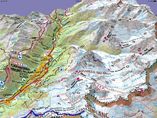
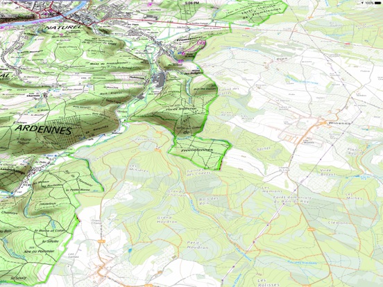
15 store screenshots


Pricing & paywalls
App Store
Shown for US
- Cartoweb topo Belgium — $9.99
- Iphigénie Carto Legacy — $22.99
- Iphigénie Carto subscription — $24.99
- iPhiGéNie Vmax — $4.99
- Italian maps — $24.99
- Outdoor Pack — $39.99
Ratings & reviews
App Store
Shown for US
-
5/5Powerful flexible navigational tool for hikers
I have been using IPhigenie for 12 years now as a navigational aid while hiking and walking in France. The access to the range of map bases in France is excellent - IGN maps of varying scales, cadastre, satellite are very helpful when I am trying to find a way through an unknown area. I can easily switch while planning or underway. I save my traces in folders and can share them with others and can import traces that I want to try and follow. I can load the maps before hiking and have full access to my position and to the maps even when there is no cellular access. In fact I started using iphigenie on an iPad without a cellular connection and later moved to an iPhone. Now I have iphigenie on my Mac also and the large screen makes it handy for planning purposes - creating new routes, editing routes and printing maps of my route (I use screenshot for this). I now have 12 years of saved tracks - mine and those of others that I have imported. I have used some of the other navigational apps and none appear to do everything that I can do with Iphigenie. With all its power, it is perhaps less intuitive than some other apps. I have read that the new developers are working to improve its ease of use. But from the beginning, I could do what I needed to do and with time, I learned to use its more advanced features. It has been an excellent tool that has helped me figure out so many great hikes and to explore confidently when I am out hiking.
Kathy-p · 6 Aug 2026
-
5/5Great App for hiking and mountaineering
I have used the app for many years. I subscribe to the French and Swiss maps and use them both for planning purposes and up in the mountains. Easy to use and saved me a few times lost in bad weather. Highly recommended.
Palle38 · 6 Aug 2026
-
5/5Fantastic maps of France
It’s amazing. The IGN maps of France are amazing and being able to access them on phone or iPad through this app, at the many scales, is so practical.
Dock user · 6 Aug 2026
-
5/5Great app
Would be lost without all these maps
Metricmike · 6 Aug 2026
-
5/5Absolutely indispensable!
Ok, so obviously several reviews are in English and the lack of English documentation is an issue they should address eventually. But as it is--for me at least--things speak for themselves! It's maps, people: you zoom in and out and back and forth and voila, all of France is on your device. I'm currently one month into a year-long hiking journey in France and the $16 price has paid for itself dozens of times over (each IGN map, printed, is not only cumbersome and heavy, but quite expensive) already. The GR trails are extensively mapped and nearly *every* feature is named and displayed, from the Louvre to ramshackle outhouses in Provence. The trail blazes themselves are sometimes sparse and less than perfect; it is then that this app is worth its electronic weight in gold. DO YOUR RESEARCH to determine if it's the right app for you, and take advantage of the English section on their website's forum BEFORE you buy. Do that, and I promise you'll thank your lucky etoiles for this app every day.
Bonrandonnee · 6 Aug 2026
Privacy & accessibility
App Store
Privacy
- Data Not Linked to You — Analytics — Diagnostics — Crash Data Developer declared
- Data Not Linked to You — Analytics — Diagnostics — Other Diagnostic Data Developer declared
- Data Not Linked to You — Analytics — Diagnostics — Performance Data Developer declared
- Data Not Linked to You — Analytics — Identifiers — Device ID Developer declared
- Data Not Linked to You — Analytics — Location — Precise Location Developer declared
- Data Not Linked to You — Analytics — Purchases — Purchase History Developer declared
- Data Not Linked to You — Analytics — Usage Data — Other Usage Data Developer declared
- Data Not Linked to You — App Functionality — Usage Data — Product Interaction Developer declared
- Data Not Linked to You — Other Purposes — Location — Precise Location Developer declared
- Data Not Linked to You — Diagnostics Developer declared
- Data Not Linked to You — Identifiers Developer declared
- Data Not Linked to You — Location Developer declared
- Data Not Linked to You — Purchases Developer declared
- Data Not Linked to You — Usage Data Developer declared
- Data Used to Track You — Location — Precise Location Developer declared
- Data Used to Track You — Location Developer declared
Accessibility
No accessibility labels collected yet.
Versions
App Store
-
14.1.3
Launch of the Outdoor Pack! It allows you to benefit from the synergy between Iphigénie and Whympr. This pack brings together everything you need to plan and enjoy your outdoor outings, whether hiking, ski touring, climbing, snowshoeing and mountaineering. In addition to the promotional price for the 2 apps, you will be able to benefit from the latest new web app allowing them to create GPX tracks and landmarks directly on your computer.
-
14.2.0
Launch of the Outdoor Pack! It allows you to benefit from the synergy between Iphigénie and Whympr. This pack brings together everything you need to plan and enjoy your outdoor outings, whether hiking, ski touring, climbing, snowshoeing and mountaineering. In addition to the promotional price for the 2 apps, you will be able to benefit from the latest new web app allowing them to create GPX tracks and landmarks directly on your computer.
-
14.2.1
Launch of the Outdoor Pack! It allows you to benefit from the synergy between Iphigénie and Whympr. This pack brings together everything you need to plan and enjoy your outdoor outings, whether hiking, ski touring, climbing, snowshoeing and mountaineering. In addition to the promotional price for the 2 apps, you will be able to benefit from the latest new web app allowing them to create GPX tracks and landmarks directly on your computer.
-
14.2.2
Launch of the Outdoor Pack! It allows you to benefit from the synergy between Iphigénie and Whympr. This pack brings together everything you need to plan and enjoy your outdoor outings, whether hiking, ski touring, climbing, snowshoeing and mountaineering. In addition to the promotional price for the 2 apps, you will be able to benefit from the latest new web app allowing them to create GPX tracks and landmarks directly on your computer.
-
14.2.3
Bug fixes and performance improvements to enhance your experience.
-
14.2.4
Bug fixes and performance improvements to enhance your experience.
-
14.2.5
Bug fixes and performance improvements to enhance your experience.
-
14.2.6
Bug fixes and performance improvements to enhance your experience.
-
14.3
Apple watch bug fix : Start a track on watch is now possible for new watch models Add new maps and layers : - Cassini historical map - Biodiv' layer
-
14.3.1
Minor version that restores some features: - Reworked HD option - New elevation grid for 3D that covers a wider range Also contains several bug fixes
-
14.3.10
New maps added and several bug fixes
-
14.3.11
This version includes several bug fixes: Fixed tile caching issues across multiple layers Resolved a rare crash occurring at startup Extended the context bar for beacon username and password fields
-
14.3.12
Improvements and maintenance
-
14.3.2
contains several bug fixes
-
14.3.3
New maps in the Italy subscription! - Il Lupo maps: Central and southern Apennines, - Geo4Map maps: Northwestern and southern Italy.
-
14.3.4
New maps in the Italy subscription! - Il Lupo maps: Central and southern Apennines, - Geo4Map maps: Northwestern and southern Italy.
-
14.3.5
This update includes: • The ability to contact support directly from within the app • An update to the minimum iOS version to improve performance • Various bug fixes and general improvements
-
14.3.6
Minor release, fixed altitude calculation issue
-
14.3.7
Added the brand-new Winter Map for enhanced mountain navigation Refreshed UI with improved design and readability Fixed minor bugs to make the app smoother and more reliable
-
14.3.8
Fixed minor bugs to make the app smoother and more reliable
-
14.3.9
This version remove dysfunctional maps from the selector and add a new OpenStreetMap layer. Also contains some bug fixes for iPad
-
14.4.0
This version add a new Italian layer Dolomites in the Italian subscription
-
14.4.1
Bug fixes and performance improvements
-
14.4.2
Bug fixes and performance improvements
-
14.5
· 17 Jul 2026
New: Explore 4 new official national topographic maps! - Sweden - Finland - Czech Republic - Japan Included with the Iphigénie Carto subscription.
Alternatives
- WeTrek – Trail, Hike & Cycling — Same category + similar ratings
- Cartes IGN — Same category + similar ratings
- geoportail.lu — Same category + similar ratings
Availability by market
- US
Data quality & evidence
- Page completeness
- Live store listing
- Last verified
- 6 Aug 2026
- Sources
- App Store
- Independent summary has not been published yet.