AppCorpus MCP gives your agent current app data, prices, screens, features and sources.
View JSON
GET /api/v3/apps/993040478
{
  "app_id": 993040478,
  "canonical_url": "https://appcorpus.com/apps/i-boating-usa-marine-charts-993040478",
  "identity": {
    "name": "i-Boating: USA Marine Charts",
    "slug": "i-boating-usa-marine-charts",
    "developer": {
      "name": "Bist LLC",
      "url": "https://appcorpus.com/developers/bist-llc-developer_03a2f79f740b640e7cd22df0e9d326c1"
    },
    "icon_url": "https://is1-ssl.mzstatic.com/image/thumb/Purple125/v4/95/31/5c/95315c81-eac1-6512-9693-886781a624f8/MarineAppIcon-1x_U007emarketing-0-7-85-220.png/512x512bb.jpg",
    "stores": [
      "apple"
    ],
    "platforms": [
      "iphone",
      "ipad"
    ],
    "status": {
      "state": "abandoned-risk",
      "label": "Abandoned risk",
      "last_checked": "2026-07-30",
      "last_checked_label": "30 Jul 2026",
      "banner": null,
      "region_note": null
    }
  },
  "listings": [
    {
      "store": "apple",
      "status": "ACTIVE",
      "url": "https://apps.apple.com/us/app/i-boating-usa-marine-charts/id993040478?uo=4",
      "rating": 4.3,
      "rating_count": 186,
      "formatted_price": "$29.99",
      "is_free": false,
      "has_iap": false,
      "has_subscription": false,
      "version": "107.0.0",
      "updated": "2021-05-27",
      "currency": "USD"
    }
  ],
  "summary": {
    "one_liner": null,
    "summary": null,
    "best_for": [],
    "not_for": [],
    "status": "fallback",
    "at_a_glance": [
      "$29.99"
    ]
  },
  "categories": {
    "official": [
      "Navigation",
      "Travel"
    ],
    "appcorpus": [
      {
        "category_id": "navigation",
        "label": "Navigation",
        "url": "https://appcorpus.com/categories/navigation"
      },
      {
        "category_id": "travel",
        "label": "Travel",
        "url": "https://appcorpus.com/categories/travel"
      }
    ]
  },
  "use_cases": [],
  "features": [
    {
      "capability_id": "family_sharing",
      "label": "Family Sharing",
      "availability": "yes",
      "access_level": "unknown",
      "scope": "App Store",
      "evidence": "Store published"
    }
  ],
  "pricing": [
    {
      "store": "apple",
      "formatted_price": "$29.99",
      "is_free": false,
      "has_iap": false,
      "has_subscription": false,
      "currency": "USD",
      "market": "us",
      "last_verified": "2026-07-30",
      "rows": [
        "Price: $29.99"
      ]
    }
  ],
  "screens": [
    {
      "url": "https://is1-ssl.mzstatic.com/image/thumb/Purple123/v4/b6/5d/18/b65d1837-2198-9567-3082-a0998c51d7c6/pr_source.png/1600x1600bb.jpg",
      "store": "apple",
      "platform": "ipad",
      "alt": "i-Boating: USA Marine Charts ipad screenshot 1"
    },
    {
      "url": "https://is1-ssl.mzstatic.com/image/thumb/Purple123/v4/11/ce/e5/11cee5a2-9b60-8b6b-ec9a-7d2775b375b1/pr_source.png/1600x1600bb.jpg",
      "store": "apple",
      "platform": "ipad",
      "alt": "i-Boating: USA Marine Charts ipad screenshot 2"
    },
    {
      "url": "https://is1-ssl.mzstatic.com/image/thumb/Purple123/v4/28/a4/d6/28a4d603-837a-6e28-09d3-8aca55f036c3/pr_source.png/1600x1600bb.jpg",
      "store": "apple",
      "platform": "ipad",
      "alt": "i-Boating: USA Marine Charts ipad screenshot 3"
    },
    {
      "url": "https://is1-ssl.mzstatic.com/image/thumb/Purple113/v4/a0/9c/17/a09c1701-dc41-3ae5-76ad-8ffa2831c4c3/pr_source.png/1600x1600bb.jpg",
      "store": "apple",
      "platform": "ipad",
      "alt": "i-Boating: USA Marine Charts ipad screenshot 4"
    },
    {
      "url": "https://is1-ssl.mzstatic.com/image/thumb/Purple113/v4/6f/0c/1d/6f0c1d56-c7f0-7e54-616b-d28aa9b781f4/pr_source.png/1600x1600bb.jpg",
      "store": "apple",
      "platform": "ipad",
      "alt": "i-Boating: USA Marine Charts ipad screenshot 5"
    },
    {
      "url": "https://is1-ssl.mzstatic.com/image/thumb/Purple123/v4/a6/08/a7/a608a749-b9d6-0128-e037-dc8203bac0f1/pr_source.png/1600x1600bb.jpg",
      "store": "apple",
      "platform": "ipad",
      "alt": "i-Boating: USA Marine Charts ipad screenshot 6"
    },
    {
      "url": "https://is1-ssl.mzstatic.com/image/thumb/Purple113/v4/b9/c9/ce/b9c9ced2-861d-7a45-4f2a-1a69c4ae313c/pr_source.png/1600x1600bb.jpg",
      "store": "apple",
      "platform": "ipad",
      "alt": "i-Boating: USA Marine Charts ipad screenshot 7"
    },
    {
      "url": "https://is1-ssl.mzstatic.com/image/thumb/Purple113/v4/be/5c/08/be5c08bb-7723-2baf-8ba4-df52be8d4d68/pr_source.png/1600x1600bb.jpg",
      "store": "apple",
      "platform": "ipad",
      "alt": "i-Boating: USA Marine Charts ipad screenshot 8"
    },
    {
      "url": "https://is1-ssl.mzstatic.com/image/thumb/Purple113/v4/6f/8c/0e/6f8c0ee5-7835-1d0d-643b-5315e19ff6d0/pr_source.png/1242x1600bb.jpg",
      "store": "apple",
      "platform": "iphone",
      "alt": "i-Boating: USA Marine Charts iphone screenshot 9"
    },
    {
      "url": "https://is1-ssl.mzstatic.com/image/thumb/Purple113/v4/1d/f4/da/1df4da7f-dfe3-3f71-fea7-f552ebffde3b/pr_source.png/1242x1600bb.jpg",
      "store": "apple",
      "platform": "iphone",
      "alt": "i-Boating: USA Marine Charts iphone screenshot 10"
    },
    {
      "url": "https://is1-ssl.mzstatic.com/image/thumb/Purple123/v4/e8/64/2d/e8642d29-df26-af98-0521-14dfd91b6e84/pr_source.png/1242x1600bb.jpg",
      "store": "apple",
      "platform": "iphone",
      "alt": "i-Boating: USA Marine Charts iphone screenshot 11"
    },
    {
      "url": "https://is1-ssl.mzstatic.com/image/thumb/Purple113/v4/06/83/ab/0683ab2b-d005-6b55-efa5-e8e8bc9894b4/pr_source.png/1242x1600bb.jpg",
      "store": "apple",
      "platform": "iphone",
      "alt": "i-Boating: USA Marine Charts iphone screenshot 12"
    },
    {
      "url": "https://is1-ssl.mzstatic.com/image/thumb/Purple113/v4/b9/f0/62/b9f0624f-f51c-e2d9-68ee-4dfd9c568c66/pr_source.png/1242x1600bb.jpg",
      "store": "apple",
      "platform": "iphone",
      "alt": "i-Boating: USA Marine Charts iphone screenshot 13"
    },
    {
      "url": "https://is1-ssl.mzstatic.com/image/thumb/Purple113/v4/30/08/03/30080330-4e53-ab1d-0fca-b79a548da060/pr_source.png/1242x1600bb.jpg",
      "store": "apple",
      "platform": "iphone",
      "alt": "i-Boating: USA Marine Charts iphone screenshot 14"
    },
    {
      "url": "https://is1-ssl.mzstatic.com/image/thumb/Purple113/v4/36/17/4c/36174c2f-1609-a1e9-6a06-881acb6a4fc6/pr_source.png/1242x1600bb.jpg",
      "store": "apple",
      "platform": "iphone",
      "alt": "i-Boating: USA Marine Charts iphone screenshot 15"
    },
    {
      "url": "https://is1-ssl.mzstatic.com/image/thumb/Purple113/v4/14/c2/63/14c263ba-ccf3-b368-7809-75785a86f525/pr_source.png/1242x1600bb.jpg",
      "store": "apple",
      "platform": "iphone",
      "alt": "i-Boating: USA Marine Charts iphone screenshot 16"
    }
  ],
  "ratings": [
    {
      "store": "apple",
      "average": 4.3,
      "count": 186,
      "market": "us",
      "observed_at": "2026-07-30",
      "reviews": [
        {
          "rating": 4,
          "title": "Nice and easy. Great buy",
          "body": "My only complaint would be to have the display stay on during operations if the phone is on charger. Other than that the app does the job.",
          "author": "Papabear0307",
          "date": "30 Jul 2026"
        },
        {
          "rating": 2,
          "title": "Waste of money for N Californians",
          "body": "Zero stars if it was possible. Yeah update coming but when. Live in northern Ca & my location is determined to be in Maine. I only downloaded maps in N Ca but call up any famous N Ca lake & boom you’re taken to East Coast. Pretty much seems to be false app advertising. I would look elsewhere for lake maps. UPDATE: Two maps were updated, thank you. So I’ll give one more star for that. But, I ended up moving on to the Navonics app. $9.99/yr. Navonics works great on my iphone, extremely detailed & saved the day when my buddy’s sonar and GPS stopped working. This one had my location in the Midwest. Getting closer. I appreciate the update for the 2 lakes but needed something that worked better for inland fishing. I found it. I’ll keep this app tucked away in a folder, because it cost so much, but mainly in hopes it improves over time. I’ll play with it periodically to check on it. Until then, I’m sorry, but I had to find a better app.",
          "author": "DesertRain102938",
          "date": "30 Jul 2026"
        },
        {
          "rating": 5,
          "title": "Excellent small boat charting option!",
          "body": "Moved recently from Florida to Utah. Have encountered a number of nautical challenges transitioning from coastal chart plotter navigation to inland lakes navigation. Garmin & Lowrance both want a fortune for their chart plotter options in both inland and coastal products. This i-boating USA app. Provides fabulous detail on both coastal and inland options for a very, very reasonable price point. Awesome option alternative to big boy price gouging for marine navigation.",
          "author": "Dorsalis",
          "date": "30 Jul 2026"
        },
        {
          "rating": 5,
          "title": "Worked perfect for me",
          "body": "We are avid boaters in Texas and like to try out new lakes. Downloaded the app and headed to Lake Texoma. Huge lake and we didn’t want to get lost or bottom out on a low spot. I ran the app concurrently with my Lowrance and the app was actually better because I could see how the under water terrain changed and could navigate around the low spots through the channels. I was able to set waypoints on fishing hotspots, etc. Just as described.",
          "author": "Pontoon Willie",
          "date": "30 Jul 2026"
        },
        {
          "rating": 5,
          "title": "Easy to use marine navigation app",
          "body": "Really easy to use and set up charts for offline use. Download grid make it easy to see what all cells to download and what charts already exist on the phone. Charts look very hi def on the phone and are all vector. Most gps features are a toggle button away. Moving map gps clearly shows the breadcrumb and works very well even for long trips.",
          "author": "Tomanserson1148",
          "date": "30 Jul 2026"
        }
      ]
    }
  ],
  "privacy": [
    {
      "store": "apple",
      "declarations": [
        {
          "title": "Data Not Collected",
          "detail": "",
          "source": "Developer declared"
        }
      ],
      "accessibility": []
    }
  ],
  "changes": [
    {
      "store": "apple",
      "version": "107.0.0",
      "released_at": "2021-05-27",
      "notes": "- Temporal Wind Prediction Overlay - Magnetic Bearing - New lakes covering Michigan, Minnesota, Florida - Compiled with latest version of Xcode"
    },
    {
      "store": "apple",
      "version": "50.0.0",
      "released_at": null,
      "notes": ""
    },
    {
      "store": "apple",
      "version": "60.0.0",
      "released_at": null,
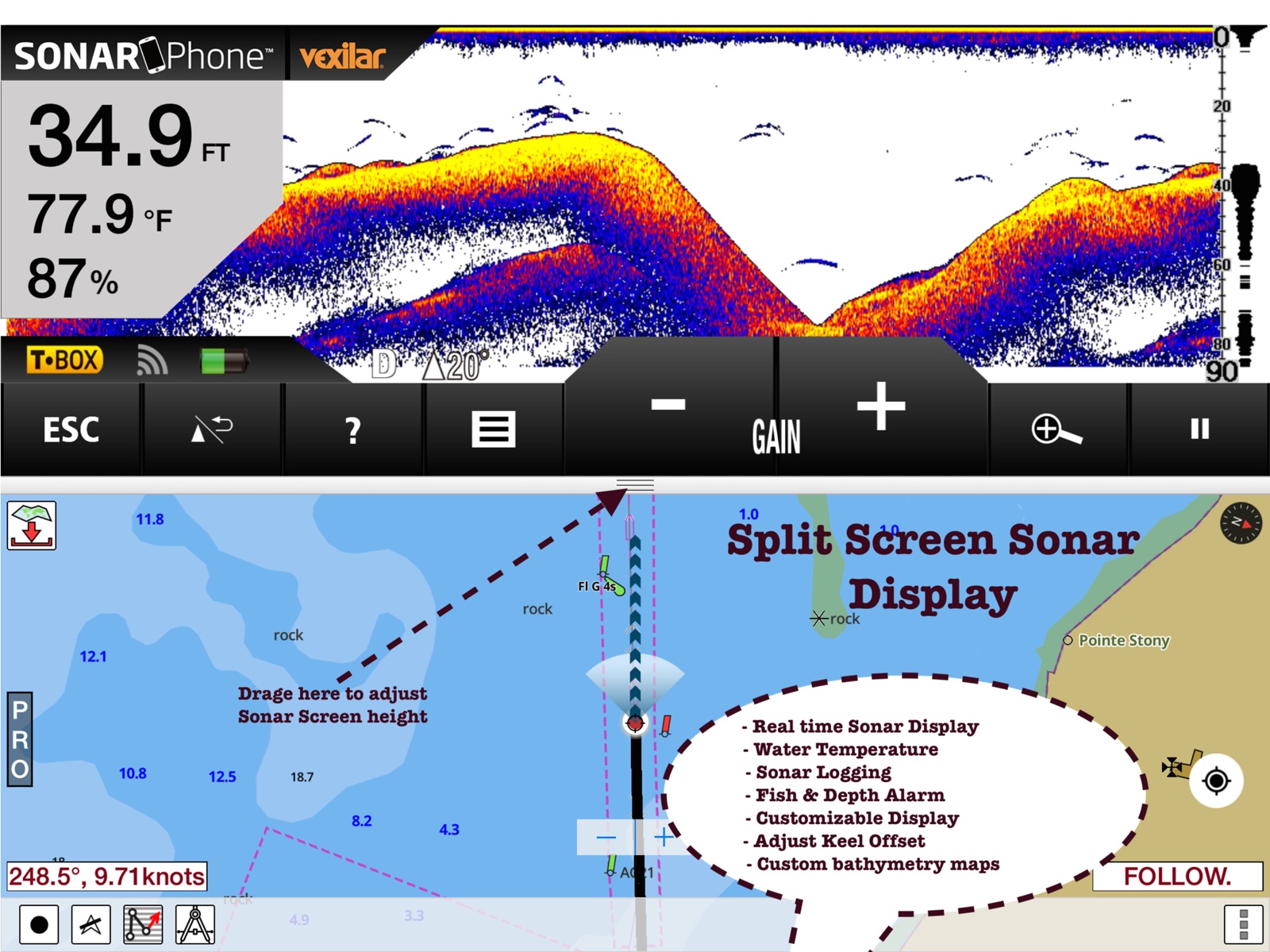
      "notes": "- AIS & NMEA Support - Sonar Phone Support - Change background to satellite imagery"
    },
    {
      "store": "apple",
      "version": "85.0.0",
      "released_at": null,
      "notes": "- Compiled with latest version of Xcode - Incorporated feedback from customers - Online maps are now default. (Offline still supported incl. strict offline mode) - Plan routes using online maps and then download just cell covering your cruising area. - Around 5K new lakes added in Wisconsin, Michigan and Wyoming"
    },
    {
      "store": "apple",
      "version": "92.0.0",
      "released_at": null,
      "notes": "- AutoPilot support: The application can now supports AutoPilot. Under NMEA Instrument settings you can now turn on Auto Pilot. When Goto WayPoint or Route Assistance is turned on, the application will send NMEA instructions to the boat's Auto Pilot over TCP. - Tide & Currents update - Compiled with latest version of Xcode - Incorporated feedback from customers - Online maps are now default. (Offline still supported incl. strict offline mode) - Plan routes using online maps and then download just cell covering your cruising area."
    }
  ],
  "alternatives": [
    {
      "app_id": 451093694,
      "name": "PRO CHARTS - Marine Navigation",
      "url": "https://appcorpus.com/apps/pro-charts-marine-navigation-451093694",
      "reason": "Same category + similar ratings"
    }
  ],
  "evidence_summary": {
    "index_state": "S1",
    "evidence_level": 1,
    "level_label": "Live store listing",
    "indexable": true,
    "last_verified_at": "2026-07-30",
    "unknown_fields": [
      "Independent summary has not been published yet."
    ],
    "sources": [
      "App Store"
    ]
  },
  "availability_markets": {
    "live": [
      "us"
    ],
    "selected": "us",
    "note": null
  },
  "feature_events": {
    "events": []
  },
  "features_slice": {
    "plans": [],
    "features": [],
    "unknown_features": [
      "family_sharing"
    ],
    "data_cutoff": "30 Jul 2026"
  }
}