
Quick verdict
- What it is
- Store information collected; independent summary not yet available.
- At a glance
-
- $9.99
Categories and search queries
Official categories
- Navigation
- Travel
AppCorpus categories
Key functions
| Function | Availability | Access | Scope | Evidence |
|---|---|---|---|---|
| Family Sharing | Yes | Unknown | App Store | Store published |
Screens
App Store
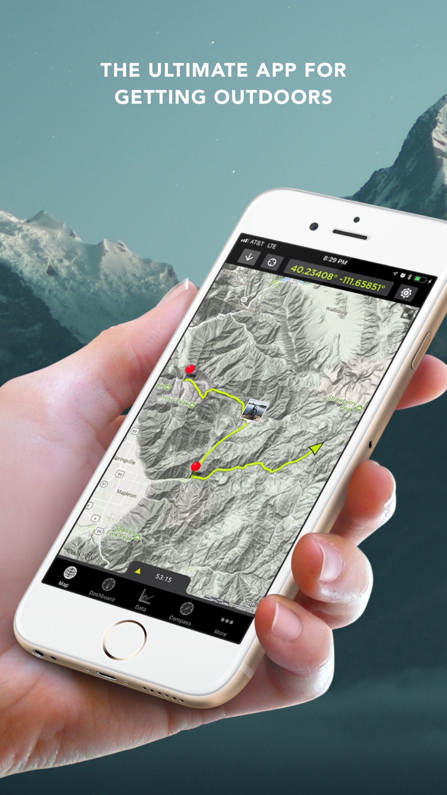
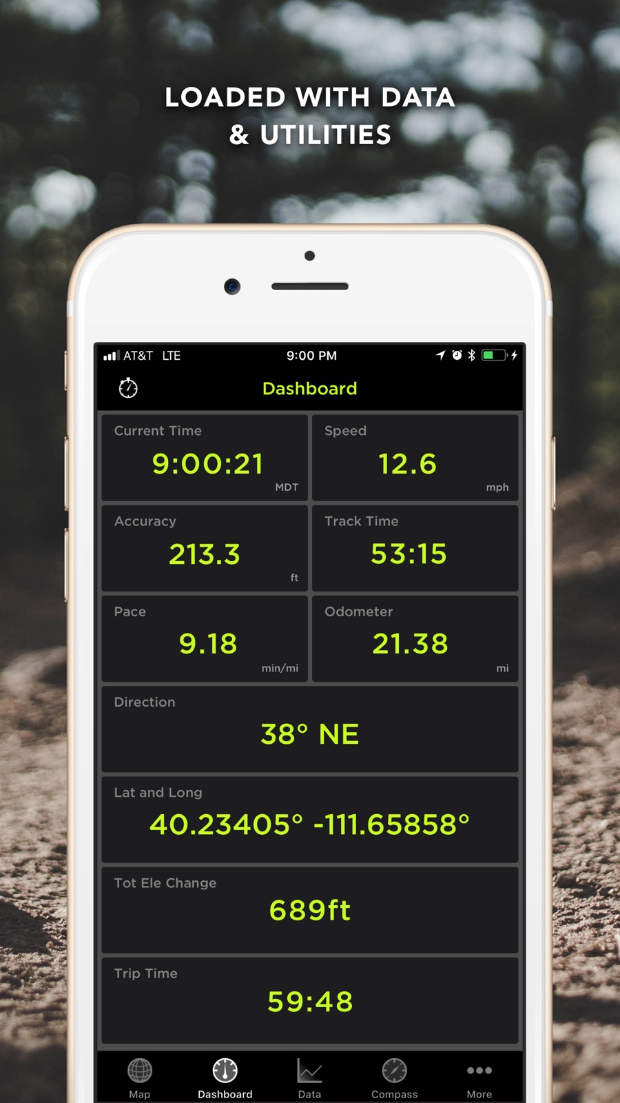
5 store screenshots


Pricing & paywalls
App Store
- Price: $9.99
Ratings & reviews
App Store
-
4/5Can’t find a better app then this
I have been using this app for many years now and I have finally came to put a post on it. It works great where there is no service. I work in SENM where there is little to no service and I can use this app anytime I enjoy the features of filtering certain things on and off. Like maps and layers of things. The only bad thing is this map doesn’t get updated enough.
freak sweet · 5 Aug 2026
-
5/5Whoever Wrote this App is a Coding Genius
I’ve been using this app since 2011 back when I was in high school. Even though I’ve switched to a combination of WorkOutDoors and Gaia GPS, this app still has a lot of my old trails saved. Every year, I expect it to stop working, but amazingly it still works just as well as in 2011. This is despite not having been updated in 8 years and still using an iOS 6 era interface. I don’t know how the developer wrote such a stable app, but this is clearly the work of a genius.
le9508 · 5 Aug 2026
-
5/5Ios 17 is not working properly
Im using this app for many years , everything is perfect , the only thing now is the bug in ios 17 which is cant share the tracks , when you push the share bottom in top right corner app is crashing and its big deal for many our friends who using this app cause we always sharing tracks between us
Ali rahbat · 5 Aug 2026
-
5/5Best navigation app
I am a commercial blue crabber and licensed tow boat captain and I use this app to keep track of 200 crab pots on the Gulf of Mexico and I also use it to locate vessels needing towing assistance. Even when I’m 30 miles offshore with no cell phone service, the offline maps never fail to guide me to my destination. So simple to use and the best tool I’ve ever seen on a cell phone
dirtyyearty · 5 Aug 2026
-
5/5I depend on it
I travel in the US and El Salvador extensively. when a guide takes me back into the jungle. I really enjoy knowing I can guide myself out with this map app. It is also nice to be able to return to the same places that people guide me without having to pay a guide fee
Fpaypal · 5 Aug 2026
Privacy & accessibility
App Store
Privacy
- No Details Provided Developer declared
Accessibility
No accessibility labels collected yet.
Versions
App Store
-
3.3
- tracks now colored by speed - new languages: Italian, German, and French - measure area using four fingers in measure mode - fixed low power mode to get a trackable point every time the gps chip turns back on - new look through out app - added reset track and new track to dashboard settings - option to turn tracking back on when adding a new track - separate tab for compass - general program optimizations and bug fixes
-
3.4
As requested: you can now turn track coloring off and you can color tracks by elevation Track graphs either by elevation or speed. Magnetic compass now turns off when you go more than 20 mph Other performance increases and bug fixes.
-
3.5
Share your location with other GPS Kit users in real-time. Great for following or meeting up. You are going to love it. Its called Radar and you can turn it on in the map settings. More intuitive starting screen. Latitude and Longitude are displayed together on the dashboard. Total Elevation Gain and Descent displays. Rotate phone in graph view for larger graph. Other performance improvements and bug fixes.
-
4.0
iOS 4 optimized New track timer controls for timed outings New & improved map engine & caching Customizable map tiles Improved track drawing Long press to create waypoint on map Delete waypoint from map Double-tap to zoom Inclinometer Improved Radar technology Turn data set visibility on/off Share & import GPX & KML via email Optional background tracking Tracks can be grouped with waypoints Improved retina interface
-
4.1
Added → Photo Waypoints → Drag and place waypoints → Add Description to waypoints → Facebook sharing of data sets → Twitter sharing of data sets → Data list thumbnails → Data list show-on-map indicator → Waypoint email/open in maps → Glide Ratio → Quicker startup time → KML import → Video How-To section → Proximity Sensor is back → And More! Fixed: → Crash with UTM → Min elevation and total descent → Color selection bug → Import from mail bug on iPad → Export cancel button
-
5.0
Added/Improved → Weather stations! Drop a virtual weather station at your favorite fishing hole, skiing route, or camping spot and get hourly forecasts specific to that spot right from the source! (NWS digital forecast--U.S. Only) → New setting to decide whether to use the magnetic or GPS compass based on how fast you are moving. → Added smooth object shrinking in map to keep clutter down → Two-finger tap to zoom out → Improved startup time → Improved smartness of tracking → Improved graph elevation filtering → Improved stability in data tab (especially with very large tracks) → Improved startup time → Improved waypoint compass Fixed: → Photos from library no longer create duplicates → Fixed bugs in dashboard → Fixed bug in long chat messages → Fixed bug where same point publishes to Facebook
-
5.1
Improved Tracking New in 5.0: → Weather stations! Drop a virtual weather station at your favorite fishing hole, skiing route, or camping spot and get hourly forecasts specific to that spot right from the source! (NWS digital forecast--U.S. Only) → New setting to decide whether to use the magnetic or GPS compass based on how fast you are moving. → Added smooth object shrinking in map to keep clutter down → Two-finger tap to zoom out → Improved startup time → Improved smartness of tracking → Improved graph elevation filtering → Improved stability in data tab (especially with very large tracks) → Improved startup time → Improved waypoint compass
-
5.2
Introducing Squawk! - Much more stable replacement of Radar - Friends - Located on the tab bar for quicker use - Much anticipated offline features - Offline chat with Push Notifications - Load friends' last position & track even when they are offline - Web Viewer (no iPhone needed to view! Even works on other mobile platforms such as Android) Other features: - Customizable tab bar - Improved data tab performance - Fixed Data tab crash
-
5.3
- Import kml and gpx files using iTunes import. - Events can be sorted by date, name, or distance from current location. - Satellite map issues are fixed.
-
5.4
- Geocodes photos when saved to the iPhone Album (iOS 4.1 and later) -Fixed bug to allow users with iOS 3.x to use the app - Other smaller bug fixes - Three finger tap the map screen to see names of all waypoints currently on the map.
-
5.5
Added Google Hybrid Maps! Geo-tagged Photos Import GPX data from Geocaching.com Fixed Google Terrain Issue Improved KML Parsing Various Bug Fixes
-
5.6
- All new offline map system with rectangular, circular, and free draw regions - Better handling of maps while offline - Added an option to always continue tracking while in the background - Fixed "Loading Track" bug - Fixed image problem where white bar would appear - Improved track controls while acquiring GPS signal - Improved use of external GPS units
-
5.7
-iOS 5 compliance -Facebook feature fixed -GIS products information in More Tab -Improved map caching -Added switch for keeping Squawk on in the background independent of tracking settings.
-
5.8
- export kmz files with all photos and notes included - gpx route import - improved gpx importing - new user guide - iOS 5 required that we changed the way background tracking works. Background tracking is always enabled. Every time the app goes into the background while you are tracking a warning is displayed. This warning can be turned off in the map settings. - fixed adding note crash - fixed black screen issue
-
6.0
New Snow Sports Additions! ❄ Ski/Snowboard runs analysis ❄ Separate uphill and downhill stats ❄ Vertical, speed, slope, distance Other Advanced Features: ✳ Color by speed and elevation are back! ✳ Color by distance/time ✳ Google Earth 3D track playback ✳ Awesome "Heli cam" GE 3D playback Also: • "Map" shortcut button for Squawk! friends • Quick picture mode (enable in system settings) • Offline documentation • Fixed thumbnail loading issues
-
6.1
- Integration with our new app "Track Editor" to make editing your tracks a seamless experience - Faster stats updating - Faster elevation graph - Allow bigger cache sessions for advanced users - Other fixes and improvements
-
6.2
Fix for gpx file exporting Fix for sharing via twitter
-
6.3
- Full-screen map option - Bug fixes
-
6.4
- Updated for iOS 6 - 4" screen support
-
6.5
Elevation Correction - You can now lookup the elevation for a whole track or a waypoint. Great for outdoor activities where you are are on the ground and want to keep track of vertical. Bug Fixes - Fixed issue where GPS would turn off in the middle of a track for devices running iOS 6 or newer.
-
6.6
- Bug fixes
-
7.0
All new update for iOS 7!
-
7.0.1
Full screen bug fixed. Map details bug fixed. 7.0 - All new update for iOS 7!
-
8.0
- updated to 64 bit - updated for modern screen sizes - fixed weather stations - fixed sharing
-
8.0.4
· 11 Feb 2019
This update from Apple will improve the functionality of this app. No new features are included. Bug fixes Previous Release: - updated to 64 bit - updated for new screen sizes - fixed weather stations - fixed sharing
Alternatives
- Global Mapper Mobile — Same category + similar ratings
- Topo GPS - Topographic maps — Same category + similar ratings
Availability by market
- US
Data quality & evidence
- Page completeness
- Live store listing
- Last verified
- 5 Aug 2026
- Sources
- App Store
- Independent summary has not been published yet.