
Quick verdict
- What it is
- Store information collected; independent summary not yet available.
- At a glance
-
- From $7.99/mo
- Free to download
- In-app purchases
Categories and search queries
Official categories
- Navigation
AppCorpus categories
Key functions
| Function | Availability | Access | Scope | Evidence |
|---|---|---|---|---|
| Free app | Yes | Free | — | Store published |
| In-app purchases | Yes | Limited free | — | Store published |
Screens
App Store
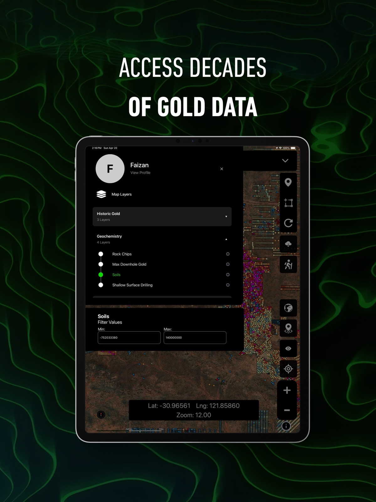
10 store screenshots


Pricing & paywalls
App Store
Shown for US
- Monthly Explorer Plan — $7.99/month
- Monthly Explorer Plan — $59.99/year ($4.99/mo)
- Monthly Plan — $11.99/month
- Monthly Plan — $99.99/year ($8.33/mo)
Ratings & reviews
App Store
Shown for US
-
5/5Best app
Downloaded this application the day it became live for the states. All of the information it gives along with the lidar aspect and old gold find recordings is excellent for research. The claim boundaries and linking to the MLRS data is also a great touch. Showing water flow and seasonal streams helps a bunch in researching areas to prospect especially near old hydraulic pits.
Wvhillbilly in ca · 5 Aug 2026
-
5/5Best App ever!!!
I have been randomly prospecting for several years now. Just in the past few months I decided to take this hobby/passion to another level. This app has been a game changer in every way possible. The creators definitely deserve a pat on the back!!
Harney43 · 5 Aug 2026
-
5/5Game changer!
This app pulls all the necessary information into one fairly easy to use format. MRDS, ACTIVE CLAIMS, HISTORIC CLAIMS, HOTSPOTS. So much more! Seriously useful information. I feel empowered to get out there and prospect.
socalgirlntx · 5 Aug 2026
-
1/5So Horrible
Does not do anything they claim. You can only look at the spot you’re currently at. The second you lift your finger off the map while searching it jumps right back to your current location. I have cancelled my 9.99 a month subscription and I can’t log in to even try to use it for my remaining 30 days. I’ll be reporting it to Apple. Don’t waist your money on this obvious scam application.
Robbbbbbbbbbz · 5 Aug 2026
-
2/5Unuseable for Idaho
I’ve never uninstalled and app and cancelled a trial so quickly. Maybe it works in other parts of the world but for Idaho - lands I know like the back of my hand - there’s no BLM/land ownership boundaries. No LiDAR. Tons of missing active claims. No historical mining info in the hottest historical area of the state. What gives? Promises made on the site (including 7 day free trial that is actually 3), but promises unkept.
bigheff · 5 Aug 2026
Privacy & accessibility
App Store
Privacy
- Data Linked to You — Analytics — Usage Data — Product Interaction Developer declared
- Data Linked to You — App Functionality — Contact Info — Email Address Developer declared
- Data Linked to You — App Functionality — Contact Info — Name Developer declared
- Data Linked to You — App Functionality — Identifiers — User ID Developer declared
- Data Linked to You — App Functionality — Location — Precise Location Developer declared
- Data Linked to You — App Functionality — Usage Data — Product Interaction Developer declared
- Data Linked to You — Third-Party Advertising — Usage Data — Product Interaction Developer declared
- Data Linked to You — Contact Info Developer declared
- Data Linked to You — Identifiers Developer declared
- Data Linked to You — Location Developer declared
- Data Linked to You — Usage Data Developer declared
- Data Used to Track You — Usage Data — Product Interaction Developer declared
- Data Used to Track You — Usage Data Developer declared
Accessibility
No accessibility labels collected yet.
Versions
App Store
-
3.0.2
Bug fixes and improvements
-
3.1.0
• Geochemistry not loading on persist fix • Geochemistry filter persisting • New UI for downloads of offline packs • Increased per user limit for downloads • New fields for property boundaries • WA geology updates • Polygon export and selection • WA, VIC, NSW, QLD geology filtering • Shallow alluvial leads opacity controllable • Waypoint and breadcrumb search crash fix • On-map opacity slider fixes • Location marker bug fixes
-
3.2.0
- New Premium QLD LiDAR - Bug fixes and improvements
-
3.3.0
- LiDAR fetching issues resolved - Geophysics added to every state - Revamped NT and SA - WA tenement expiry filtering - Other bug fixes
-
4.0.0
Brand New User Interface designed for faster, easier use outdoors Simplified Menus for quick access while detecting New “My Data” Panel to easily manage your waypoints and breadcrumbs Nearest Breadcrumbs View so you can instantly see what’s closest to you Waypoint Images – snap photos of your finds in the field and sync across devices Major Optimisations for smoother performance Revamped Offline Maps – download 30+ blocks and head into the field fully offline devices
-
4.2.0
England Region Added (Coin & Relic Maps) Freemium Subscription Added
-
4.2.1
- Bug Fix
-
4.3.0
- Mining Claims now can be toggled individually by type (Placer, Lode, Tunnel, Mill) - California LiDAR update (much faster, more detailed)
-
4.3.1
Performance optimisation
-
4.4.0
- Added 50+ new USA layers to all 15 states - Improved layer performance - Updated legends and icons - Enhanced popups - UI improvements
-
4.4.1
- Improvements and optimization - Geochemistry element filter
-
4.4.2
- Bug optimisations
-
4.4.3
- Preparation for new feature - Bug fixes
-
5.0.0
- Introducing Community — connect with detectorists across the country, show off finds, and unlock achievements & prizes as you detect - Backend rebuilt for serious speed and reliability improvements
-
5.0.1
Bug fixes
-
5.1.0
- Performance Upgrades
-
5.1.1
Bug fixes
-
5.2.0
Our biggest update yet. Two big Explorer upgrades, included on every plan: • Image georeferencer — drop your own maps onto the live map: old leases, historic scans, even a photo or screenshot, pinned to real coordinates so you can navigate straight off them in the field. Now with uploads up to 1GB. Supported formats for GeoTIFF, PDF, PNG, JPG. • Community maps — unlimited access to maps shared by fellow detectorists and prospectors, ready to load straight into your own setup. New region: British Columbia, our first in Canada. Improved: New Zealand, rebuilt from the ground up. New Pro Subscription (Australia, British Columbia and New Zealand): • Report search — search a database full of exploration reports by keyword, company or commodity in each region. The map lights up as a heatmap of mentions; tap a hotspot point to open the reports underneath. • Activity alerts — know the moment ground changes, with daily tenement, claim and permit alerts (available to all US users). Plus performance improvements and bug fixes.
-
5.3.0
Offline LiDAR Download high-resolution LiDAR hillshade for any area and use it fully offline. We check coverage before you download, so you never waste space on an empty area — then show live progress as your terrain saves. A dedicated Offline LiDAR toggle lets you switch your saved hillshade on and off anytime. Perfect for reading the lay of the land in remote spots with no reception. Available in Victoria, New South Wales, Queensland, California, New Zealand, British Colombia. Rebuilt location & trail tracking We upgraded our core GPS engine for more accurate, more reliable tracking in the field: • A smoother, more accurate location puck — now consistent on iPhone and Android, with the right heading whether you’re walking or driving • More dependable trail recording, with automatic resume if the app is closed or interrupted mid-recording • Better follow-mode that keeps you centered and steps out of the way the moment you pan the map • The map now reopens right where you left off, instead of jumping to the middle of nowhere • More reliable background tracking and improved battery behaviour Faster and smoother A big performance pass across the map means smoother panning and quicker response. Plus: • Ground Scanner — swipe through your result photos full-screen • Import your own maps as JP2 and PDF, with a new georeferencing flow • Export selected items from My Data • Tap overlapping mining claims to see every claim at that spot • Lots of smaller fixes and polish Happy hunting!
-
5.4.0
NEW: COIN & RELIC FOR THE USA Detector Maps now covers coin and relic hunting nationwide, not just gold country. Choose Coin & Relic when picking your region and hunt old towns, homesteads and long-forgotten ground — coast to coast. NEW: Detector Maps Academy A built-in crash course on the whole app — 34 short video lessons, most under a minute. Layers, LiDAR, waypoints, trails, offline maps and Pro tools: watch in order or jump straight to the tool you need. NEW: Detector Grids Plan complete, methodical coverage of an area with adjustable search lanes you can follow while recording your trail. NEW: Historical Maps Catalog Browse a catalog of historical maps and overlay them on today's map to see what stood there a century ago. NEW: Cross-Platform Map Syncing Your geo-referenced maps now sync between your phone and the web app — research at the desk, detect in the field. Plus bug fixes and performance improvements throughout. Happy hunting — Matt & Tom
-
5.5.0
- Bug Fixes
-
5.5.1
- Bug Fixes
-
5.5.2
• Weather for detectorists — live conditions and a 7-day outlook for exactly where you're standing, right at the top of the layer panel. Tap any day for wind, rain chance and a quick "worth getting out?" read. • Drop a pin — long-press anywhere on the map for coordinates you can copy or share, distance from your location, the weather out there, and a one-tap Add Waypoint. • 3D terrain revamp — flip the new 3D toggle and the map tilts into view automatically. Drag with two fingers to change the angle. • Waypoints, levelled up — 16 colours with a new colour picker, icons and labels that scale as you zoom, creation dates in the popup, and tighter add/edit sheets that stay above the keyboard (much nicer on iPad too). • Import everything — KML, GPX, TCX, GeoJSON and CSV all supported. Trails, waypoints and areas each land in the right place automatically, including Trilobite exports and GPS tracks recorded with pauses. • Trail recordings now show how long you were out. • Offline downloads are sturdier — failed areas retry and the rest keep going. • Crash fixes across the board for a smoother day's detecting. Happy hunting!
-
5.5.4
- Bug Fixes
-
5.5.5
· 1 Aug 2026
- Trails not displaying in some cases - California Forest Service layer now renders (zoom 12–16) - Historic Topo bug fix - Android layer panel bug fix
Alternatives
- 3D Mappa - GIS & Topo Models — Same category + similar ratings
Availability by market
- US
Data quality & evidence
- Page completeness
- Live store listing
- Last verified
- 5 Aug 2026
- Sources
- App Store
- Independent summary has not been published yet.