
Quick verdict
- What it is
- Store information collected; independent summary not yet available.
- At a glance
-
- Free to download
Categories and search queries
Official categories
- Navigation
- Travel
AppCorpus categories
Key functions
| Function | Availability | Access | Scope | Evidence |
|---|---|---|---|---|
| Free app | Yes | Free | — | Store published |
Screens
App Store
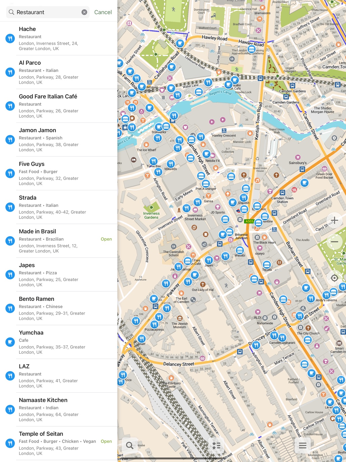
7 store screenshots


Pricing & paywalls
App Store
Shown for US
- Free
Ratings & reviews
App Store
Shown for US
-
5/5A must-have tool for the outdoors
I use and recommend this app to everyone I meet when out hiking in the woods and mountains. The ability of it to download maps and display trails and contours are extremely valuable when navigating unfamiliar trails. I would love for it to have more hiking-related features like the ability to read waypoints from GPX files and compute distances to easy waypoint while navigating and the ability to reverse the route akin to Garmin’s Up-Ahead and Trackback features.
Thanosian · 7 Aug 2026
-
4/5Supplementing Apple Maps for photography
I really like the detail available in this map app! While it isn't as feature rich as the big corps, the fact that this map can point out individual lamp posts, fire plugs and trash cans is nice. I like to use them as markers, while I'm searching for my shot or want to make finding a specific location easier. Really, it's not going to take much more before Apple and Google start to get nervous I hope that the devs can service the marker feature. Custom names and icons would make locations easier to identify your saved locations
Duzzenmatta · 7 Aug 2026
-
5/5Fantastic
Been looking at alternatives to the large monopolizing companies that collect data. I don’t usually use the driving feature, but look up a location and then memorize how to get there (to the best of my ability) and sometimes pull the map back out if I’m having trouble or get lost, but it’s been great for me. I really love that I can download certain areas and don’t have to worry about losing the map if I’m in a bad service spot.
Hausgbear · 7 Aug 2026
-
5/5Very efficient
The app is simple and clear to use. It makes you download the map data for a region ahead of time, so it doesn’t use your mobile data while you use the app later, as far as I know. Something really nice that I’ve noticed is that while in navigation mode, it’s very light on battery consumption. Other maps apps usually burn through battery quite fast while in navigation mode.
EaNasir · 7 Aug 2026
-
4/5Great FOSS alternative!
As someone who uses offline maps most of the time, this is a pretty good alternative to commercial map apps. I like its feature set, but I do wish it had less feature disparity (in things like lane guidance) and there are some occasional glitches here and there, as well as some mainstream features lacking. But the devs (who definitely have a better structure than Organic Maps) are working hard on them, and I’ll update this review when those features arrive.
AuroraAustralis53 · 7 Aug 2026
Privacy & accessibility
App Store
Privacy
- Data Not Collected Developer declared
Accessibility
No accessibility labels collected yet.
Versions
App Store
- 2025.06.25
-
2025.06.30
- OpenStreetMap data as of June 22 - Updated transit station icons - Matched parking color in navigation mode to the normal map style - Now actually ending a search when a route starts - Made sure the whole location button is visible during routing - Removed a thin black line, that appeared on the app icon on some devices
-
2025.07.23
Introducing the CoMaps logo! - OpenStreetMap data as of July 13 - Reassignable left main button - Added setting to change map appearance separately from general interface appearance - Panoramax Pictures links can now be displayed for POIs - Altitude contour lines for many regions have been upgraded to 20 or 50 meters steps and improved generally - Wetlands are now split into several distinct types - Added color fills to more features and displaying the fills earlier for existing ones - Updated vegetation and other map colors and icons - Switched the settings and help areas to using more modern technologies - Multiple other adjustments of interface icons and colors
-
2025.08.13
- OpenStreetMap data as of August 4 - Added a setting for map language - Now respecting the language order set in the system for map items - Improved map colors for water, forests, scrubs, various amenities, pedestrian areas etc. - Added ranger stations, covered bicycle parkings, escape games, luggage lockers, post office partners - Upgraded altitude contour lines to 20m step for some popular hiking regions - Support for more search abbreviations and aliases - Added search and bookmark icons for fast food, bicycle and charging stations
-
2025.08.31
- CarPlay is finally available! - OpenStreetMap data as of August 22nd - Improved dark map style - Colored place labels - Routing takes turns, traffic lights etc. into account - Double tap to zoom improved - Display the date when a place's existence or opening hours were last confirmed - Using yellow color for opening hours, if the place opens in the next 15 minutes - Added animal shelters, wicket gates and generic non-specified barrier lines - Add standalone addresses via OSM editor - Render ladder lines and routing through them (via the OM project)
-
2025.10.02
- OpenStreetMap data as of September 6 - Adjustments for iOS 26 - Branch information - Turn penalties for bicycle routing - Updated icons for towers, nightclubs, chemists, flagpoles - Save bookmark color to GPX exports (via OM project) - Color fill pedestrian parts of squares - Fix somes bugs on iOS and Carplay
-
2025.10.16
- Added option to avoid steps - Added specific icon for bus stations - Fixed hang on launch in certain rare conditions - Improved search in multiple languages - CarPlay and other small fixes (via OM project)
-
2025.11.07
- OpenStreetMap data as of November 4 - Recategorized map icons including some new colors for entertainment, sports and other businesses - Added icons for different sport centres, event venues, massage salons, guest houses and some disused businesses - Added bandstands, backless benches and loungers - Added specific icon for light rail - Multiple search improvements - Showing public transport stop references - Display navigation voice and change instructions in settings
-
2025.11.19
- OpenStreetMap data as of November 16 - Added trees - Added several seamarks - Added many other new POIs like lifebuoys, emergency access points, soup kitchens, food banks, food sharing, car pooling spaces, boat rentals, indoor play centres or day spas - Show sand areas on the map - Made adjustments to road shields in several European countries - Made bus stop icons smaller and show up earlier - Added option to avoid paved roads - Added icons to routing options - Fixed duplicate note uploads to OSM - Fixed some CarPlay issues
-
2025.12.11
- OpenStreetMap data as of December 9 - Improved search results ranking - Enabled Lithuanian and Latvian in voice announcements - Base zoom level on distance to next turn - Fixed voice directions pronouncing weird symbols in the beginning when Announce Street Names feature is enabled
-
2025.12.19
- OpenStreetMap data as of December 17 - Avoid using parking aisles for routing - Improved French search synonyms - Added irrigation hydrants - OSM editor: check length limit for OSM tags in value validation
-
2025.12.28
This is a maps-only update just to keep your maps fresh! - OpenStreetMap data as of December 27
-
2026.01.08
- OpenStreetMap data as of January 6 - Added some complicated POI types with multiple tags to the editor - Added miniature railways and wastewater treatment plants - Fixed CarPlay crash when changing speed camera settings - Removed fictional speed limits for link roads - Less sensitive long tap for hiding the map buttons
-
2026.01.24
- OpenStreetMap data as of January 22 - Added subtle dark borders to roads - Renamed "Bookmarks & Tracks" to "Favorites" and "Bookmarks" to "Places" - Added tactile information maps, railway turntables and emergency disaster help points - Always use light map appearance by default - Added position mode toggle for CarPlay - Use native languages for world overview map - Remember location mode between sessions - Fixed routing crashing on some devices - Removed decimals in current speed - Removed unused compass calibration setting
-
2026.02.09
- OpenStreetMap data as of February 7 - Allows choosing CoMaps as the default maps app - Disabled 3D buildings in CarPlay navigation mode - More clear setting for alternative map languages - Added marina fuel docks - Show favorites and search icons above subway lines - Show house numbers later - Enabled searching for Scandinavian letters æøå - OSM editor: automatically update last date when POI existence was checked
-
2026.02.23
- OpenStreetMap data as of February 21 - Displaying the number of rooms for certain places - Added tree rows and youth centres - Added Croatian, Italian, Dutch and Polish Wikipedia articles - Fixed transliteration and some other inconsistencies with map languages - Enabled searching for letters äö - Show multi-line titles in favorites lists
-
2026.03.09
- OpenStreetMap data as of March 7 - Show charge amounts for usage of facilities - Fixed subways display and routing in several cities - Improved OSM contribution section in POI info card - Re-structured settings and added icons - Show population of cities, towns, etc. - Carplay: adjust position of location arrow during navigation - Allow zooming with external input devices - Added drinking water shops - Fixed display language of Wikipedia articles - Don't add trailing whitespace for category searches and search history
-
2026.03.23
• OpenStreetMap data as of March 21 • Added sports: four square and boules • Updated POI info card icons • Prevent secondary name from appearing for e.g. streets in multi-language regions • Support maxspeed definitions for more road types in different countries
-
2026.04.07
• OpenStreetMap data as of April 5 • Outdoor style: more prominent roads with contrast borders • Added pickleball • Increased visibility of tree rows and trees in outdoor style • Added road shields specific to Argentina, Uruguay and Bolivia and removed duplicate shields • Fixed several intermittent crashes
-
2026.04.23
• OpenStreetMap data as of April 21 • More contrast water labels in light mode • Outdoor style: removed not useful footway borders at overview zoom levels
-
2026.05.06
• OpenStreetMap data as of May 4 • "Check for updates" button in the download screen to get new maps without updating the app (weekly map updates are planned) • When navigating show in-route traffic lights only, but with bigger icons • Added track recording button in navigation mode drawer • Added Slovenia specific road shields • Added Indonesian Wikipedia articles • OSM editor: fixed categories search in regional languages e.g. Brazilian Portuguese or Australian English
-
2026.06.05
• OpenStreetMap data as of June 3 and further weekly updates via "Check for updates" button in the download screen • Better "Check for updates" button styling; display map dates, error and other messages • Added organic options availability info for POIs like restaurants and supermarkets • OSM Editor: added recent categories history • Subway layer additions: Kiev, Charleroi, Nantes light rail and Paris Transilien network
-
2026.07.16
• Added road shields to next turn direction signs • Added lane guidance and improved next turn descriptions (in CarPlay too) • Improved turn instructions for roundabouts, U-turns and other cases • Added turn-by-turn directions preview to the route building screen • Rotate the map slightly towards route while in driving navigation • Display numbers of parking spaces with electric chargers and for disabled drivers • More preference for nearby results in search • CarPlay: added exit number to the roundabout directions sign • Outdoor style: softened borders of minor (white) roads • Added stages, animal boarding places and planetariums, Brazil, Norway and grey Latvia road shields • Reduce ferry landing penalty for cars routing • Always check for updates before downloading maps • OpenStreetMap data as of July 14 and further weekly updates
-
2026.07.25
· 29 Jul 2026
Hotfix to solve one crash in 2026.07.16 • Added road shields to next turn direction signs • Added lane guidance and improved next turn descriptions • Improved turn instructions for roundabouts, U-turns and other cases • Added turn-by-turn directions preview to the route building screen • Rotate the map slightly towards route while in driving navigation • Display numbers of parking spaces with electric chargers and for disabled drivers • More preference for nearby results in search • CarPlay: added exit number to the roundabout directions sign • Outdoor style: softened borders of minor (white) roads • Added stages, animal boarding places and planetariums, Brazil, Norway and grey Latvia road shields • Reduce ferry landing penalty for cars routing • Always check for updates before downloading maps • OpenStreetMap data as of July 14 and further weekly updates
Alternatives
- Organic Maps・Offline Maps, GPS — Same category + similar ratings
- OsmAnd Maps Travel & Navigate — Same category + similar ratings
- TomTom - Maps & Traffic — Same category + similar ratings
- Magic Earth Navigation & Maps — Same category + similar ratings
- Open GPX Tracker — Same category + similar ratings
- HERE WeGo Maps & Navigation — Same category + similar ratings
Availability by market
- US
Data quality & evidence
- Page completeness
- Live store listing
- Last verified
- 7 Aug 2026
- Sources
- App Store
- Independent summary has not been published yet.