
Colorado Trail Explorer
by State of Colorado Governor's Office of Information Technology
iPhone · iPad
Quick verdict
- What it is
- Store information collected; independent summary not yet available.
- At a glance
-
- Free to download
Categories and search queries
Official categories
- Navigation
- Travel
AppCorpus categories
Key functions
| Function | Availability | Access | Scope | Evidence |
|---|---|---|---|---|
| Free app | Yes | Free | — | Store published |
Screens
App Store
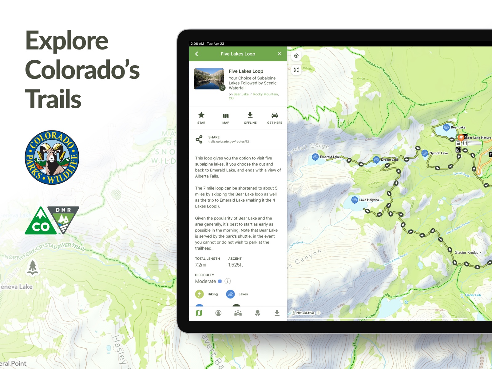
7 store screenshots
Pricing & paywalls
App Store
Shown for US
- Free
Ratings & reviews
App Store
Shown for US
-
4/5Been Waiting for This!
Finally a trail navigating app that is run by the people that control the trails! I only just downloaded the app, I will update this review when I take it out and use it around the Taylor Park area. Huge props for actually having the trail names on here, instead of just the trail numbers. That one feature makes it better than the other apps that I have been using for trail navigation. One suggestion to the developers: take the community aspect of this app to the next level. Make it to where you can add friends and leave comments on each trail that can either be seen by friends only, or the public. This would enable people to warn trail goers of dangers (rockslide, fallen trees, etc.). Also make it to where you can form a group. Say you are riding with 4 other people that each have their own OHV/ATV. You could share a pin/waypoint with the whole group so that if anyone gets separated, they would know where to go. Add the ability to send a distress call, that can be seen be sent to all nearby app users as a push notification. (For example: “Ran out of gas”, or “rollover, broken leg, need help”). This app is already amazing, but also has so much more potential! Thanks devs!
Locologo94 · 31 Jul 2026
-
4/5Good, but disappointed with developer
This is a good app, and a great alternative for Colorado residents who don’t want to pay a subscription for a commercial app. I still prefer AllTrails for the kinds of hikes that I do, but still cross-reference with COTrEx from time to time. Both apps have both false negatives and false positives in terms of trails. It is a bit disappointing for a CPW-sanctioned app to be missing trails that clearly exist in the real world (and aren’t just social trails), and to generally be outdated. My biggest disappointment is the slow turnaround time on bug-fixing, all too common in software development these days. I reported a bug more than a year ago about the keyboard covering the bottom of your Trip description, and even submitted a screen recording illustrating the issue. A PM immediately responded saying they would get it fixed. More than a year later, and I still have to use the website to type Trip descriptions, despite the app having received multiple updates in that time.
Valana · 31 Jul 2026
-
2/5I used to love this app…
Okay, so after I wrote the scathing review, I found the red button - which does not show up on opening page, you must press the directional arrow in lower menu bar to find it - & recorded my walks. Two days in a row the same 5.6 mile trail I’ve walked for two years is now 7.1 & 7.2 miles respectively. I am comparing this to another mapping app which has always read within 0.2 miles of COTREX, so I know the original mileage was correct. Much as I’d like to brag about walking 7 miles daily before breakfast, that’s just not accurate. I always carry my phone in side pants pocket so there is no chance of extra movement being the sudden difference. Please fix this!!! —————— …until the recent update that removed the Record A Trip feature. I hike daily with my dog near our home & thus am familiar with the official trails. We often go off trail through the woods, sometimes using COTREX to stay oriented & always to keep track of our route. Now all that’s available is the Create Route feature which makes assumptions about where I want to go based on input of only 2 location points, completely useless. After I transfer my 190 recorded trips to my computer, I’ll be deleting this app. So disappointed!
Ida's Mom · 31 Jul 2026
-
5/5Best hiking app for Colorado
I have used almost every hiking app. This is the best for CO. By tapping the trailhead icon you can get directions, see miles and elevation, see exact weather conditions after scrolling down, (Temp, dew point, wind, windchill, direction of wind, surface wind and gusts, rain, snow, lightening, thunder…). Many other apps limit your trails to THIER configuration. With this app you can connect trails and make your own, see elevation gain, see dispersed camping areas, easily see water sources, etc. It takes a little bit to see all that this app can do, just keep clicking and exploring. I rarely use the filter to look for specific types of trails. I just use the map and look for established trails and trails I can connect together on my own. Links take you directly to the trail manager or park service. Some trails are managed by different counties or are in multiple forests/state parks; knowing what jurisdictions you are in comes in handy for emergency communications and/or rules, closures, etc. I have made over 60 trails and keep making more, love this app!
Janiebobani · 31 Jul 2026
-
5/5Wish every state had one!
I love this thing. So, so much better than having to use multiple forest service maps, BLM, etc. to find and plan a great hike. Also adore how it shows trail systems operated by smaller agencies — counties, towns, state parks, etc. — that you would miss by consulting only the federal agency maps. It’s a real breakthrough to have all of these things in one place. It makes me sad when I am traveling outside Colorado and have to fall back on Alltrails. Ugh. The maps on Alltrails are OK but since it’s all crowdsourced and the underlying maps arent as good or inclusive, it really constricts your options. I am outside the state a lot so I’m looking into Gaia GPS, but really I’d love it if all states copied COTREX. Another thing that’s great about COTREX: it works on my crappy poor-person phone (2020 iphone SE). I love you COTREX! Never change!
stephanieinNJ · 31 Jul 2026
Privacy & accessibility
App Store
Privacy
- Data Linked to You — Analytics — Identifiers — User ID Developer declared
- Data Linked to You — Analytics — Search History Developer declared
- Data Linked to You — Analytics — Usage Data — Product Interaction Developer declared
- Data Linked to You — App Functionality — Contact Info — Email Address Developer declared
- Data Linked to You — App Functionality — Diagnostics — Crash Data Developer declared
- Data Linked to You — App Functionality — Identifiers — User ID Developer declared
- Data Linked to You — Developer’s Advertising or Marketing — Contact Info — Email Address Developer declared
- Data Linked to You — Developer’s Advertising or Marketing — Contact Info — Name Developer declared
- Data Linked to You — Developer’s Advertising or Marketing — Identifiers — User ID Developer declared
- Data Linked to You — Product Personalization — Identifiers — User ID Developer declared
- Data Linked to You — Contact Info Developer declared
- Data Linked to You — Diagnostics Developer declared
- Data Linked to You — Identifiers Developer declared
- Data Linked to You — Search History Developer declared
- Data Linked to You — Usage Data Developer declared
Accessibility
No accessibility labels collected yet.
Versions
App Store
-
1.2.1
- Stability Improvements
-
1.2.2
- Stability Improvements
-
1.2.3
- Stability Improvements
-
1.3.0
- Improved Trail Closure Notices - Stability Improvements
-
1.3.1
- Stability Improvements
-
1.3.2
- Fixed crash that occurred for some users when zooming in to see new closures
-
1.3.3
- Stability Improvements
-
1.3.6
- Stability Improvements
-
1.4.0
New Features: - Closure & Alert Subscription Service - Weather Forecast Links - Custom Route GPX File Downloads - GPS Direction Indicator - Keep Screen On While App Active - New Help Center System Updates: - Measure Tool Now Works Offline - Coordinate Sharing Improvements - Bug fixes and other minor improvements
-
1.4.1
- Stability Improvements
-
1.4.3
- Stability Improvements
-
1.4.4
- Stability Improvements
-
1.4.5
- Stability Improvements
-
1.4.6
- Stability Improvements
-
1.4.7
- Stability Improvements
-
1.5.0
- New Navigation Mode (a streamlined interface for when you are on the trail) - New Trip Trimming Feature (crop your trips after recording if you recorded more than you intended to) - Added scale bar - Added indicators for your current coordinates & elevation - Map can now can be rotated
-
1.5.1
- Re-added "Record a Trip" button to add menu
-
1.5.2
- Stability Improvements - Fixed bug affecting description editor
-
1.5.3
- Stability Improvements
-
1.5.4
- Fixed crash affecting devices using iOS 12
-
1.6.1
- Wildfires and Prescribed Burns are now on the map - Stability Improvements
-
1.6.2
Stability improvements
-
1.7.1
- New Avalanche Forecast Overlay - Stability Improvements
-
1.7.2
The map now shows restricted areas for snowmobiles when in snowmobile mode
-
1.7.3
· 17 Mar 2026
Stability Improvements
Alternatives
- RTD MyRide — Same category + similar ratings
- CalTopo: Backcountry Mapping — Same category + similar ratings
Availability by market
- US
Data quality & evidence
- Page completeness
- Live store listing
- Last verified
- 31 Jul 2026
- Sources
- App Store
- Independent summary has not been published yet.